How AI is improving agriculture sustainability in India

For India, agriculture is critical. Roughly half of its population depends on agriculture for its livelihood, and the country has the second largest arable land area in the world. As a lead producer of products like rice, wheat, cotton, sugar, and dairy, India’s agricultural system is essential not only to itself, but also to the rest of the world.
However, India’s agriculture system is facing serious challenges. More efficient crop yield is necessary to continue feeding India’s 1.4 billion people. Climate change disrupts our agricultural systems, and at the same time, unsustainable farming practices exacerbate climate change through significant greenhouse gas emissions, water usage and deforestation. Without change, food and environmental systems across the world are at risk.
Two teams at Google, AnthroKrishi and Google Partner Innovation, are leveraging AI to tackle this challenge, aligned with Google’s AI Principles. The teams’ goal is to progress agricultural sustainability, beginning with India. The team is working on a whole body of AI-powered technologies to organize and utilize India’s agricultural data, the most foundational of which is developing a unified “landscape understanding.”
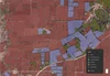
Landscape understanding leverages satellite imagery and machine learning to draw boundaries between fields, the basic unit of agriculture and essential in creating meaningful insights. With field segments established, the model can determine the acreage of farm fields, forest and woodland areas, and can identify irrigation structures like farm wells and dug ponds to build tools for drought preparedness.
High level maps provide aggregated stats (e.g., area sown, normal rainfall, actual rainfall) for the district, sub-district or village level

The research team is also developing “landscape monitoring” models, which provide a more detailed picture of an individual field’s current performance and future needs. Future landscape monitoring models would be able to determine data like crop type, field size, distance to water, and a crop’s last sow or harvest date. The team also hopes to provide in-depth data about farm ponds — information like water availability over the past month, year, or three years would be critical in establishing water security and drought management strategies.
A closer look allows users to explore segmentation of fields, tree crops and bodies of water.
Future landscape monitoring capabilities provide users with in-depth information about an individual field’s crop history, including crop type and sow and harvest schedule.

This research was made possible through meaningful partnerships with state governments, academic institutions and local communities. A shared vision across these partnerships was essential — Rama Devi, Director of Emerging Technology of Telangana State, noted that AI is “ a powerful tool for governments to drive transformational impact across sectors … while impacting lives at scale.” The team also partnered with the state government of Telangana to conduct field research, including visits to villages to work with local farmers to better understand their current needs and get feedback on field boundary accuracy.
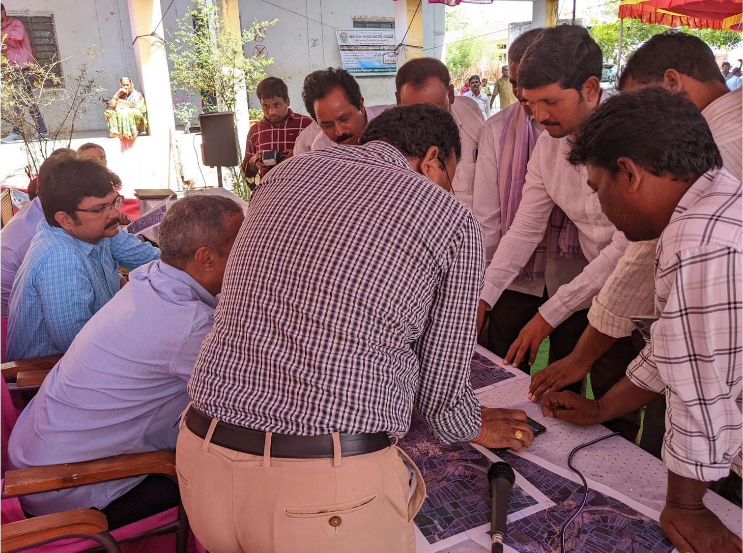
Farmers and villagers provide feedback during the team’s visit to Yellaram, Telangana.

Farmers and villagers provide feedback during the team’s visit to Yellaram, Telangana.

Farmers and villagers provide feedback during the team’s visit to Yellaram, Telangana.
This field data is key to unlocking the potential of India’s agricultural power — with a deep and accurate understanding of field performance and ever-changing environmental conditions, farmers can reduce land and water waste while increasing their crop yield. However, the impact of these insights extend well beyond individual farmers and empower India’s entire agricultural ecosystem. With more information on farm performance and needs, agricultural loans become more accessible and state governments can support several farming districts at scale. This information also supports India’s rapidly growing agricultural technology industry, as new technologies are developed to make farming practices more efficient and sustainable.
Our climate and food systems are deeply interconnected — as the impacts of climate change become more severe, the world’s food security will depend on the resilience and innovation of our agricultural systems. And if unsustainable farming practices continue, the strain on our environment will only get worse. Complex, systemic issues like these call for big solutions. And with the application of AI and other advanced technologies, we hope to tackle these challenges around the world.